
By Christopher B. Daly
Thanks to TNR and this terrific piece by Susan Schulten about two very powerful maps that could have (and should have) shaped the settlement of the United States. Essentially, they tell the same story: do not attempt European-style agriculture west of the long-grass Great Plains.
Here’s a map made by the great one-armed Western explorer John Wesley Powell for the U.S. Geological Survey:
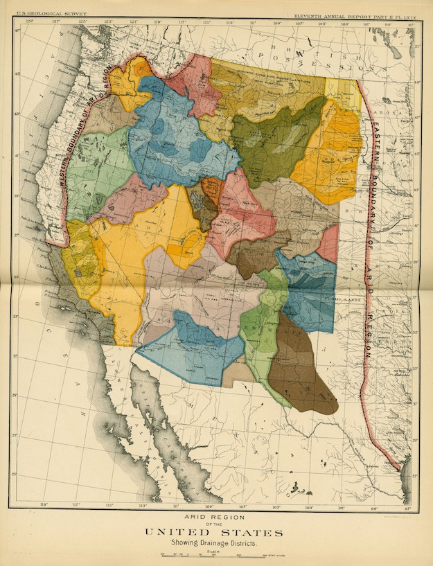
In it, he drew a north-south line from the middle of North Dakota to Houston and warned against even attempting to farm those areas (except for the far West Coast). The wonderfully colored areas depict the watersheds of the region’s major rivers.
And here’s an earlier map showing rainfall totals across the country. Again, the message is pretty clear.

U.S. rain chart

It is sadly often forgotten that many of the early explorer/mappers risked or lost their lives to obtain the knowledge in the maps. They were the astronauts of their day.
Incidentally, you and your followers might enjoy the report in today’s Wall Street Journal that Al Jazeera has been fighting hard to prevent the opening of court records involving its lawsuit against AT&T over seeking to force AT&T and AT&T subscribers to have Al Jazeera in the cable slots obtained through political clout and sold at an enormous profit by Al Gore. AT&T–hardly a bastion of first amendment rights–has not opposed the opening, but Al Jazeera takes a very different vie of transparency, secrecy and the public’s right to know.
LikeLike
Thanks, David, but I canceled my subscription to the WSJ after Murdoch bought it — not because he bought it, but because he declared at the time that his intention was to put the NYT out of business. Not just to outdo it but to eliminate it.
LikeLike
Even worse, I think his real intention is to eliminate not just the Times, but the Democratic party. It is disappointing how few WSJ staffers, if any, have dared to speak up.
LikeLike